This is how I use Foreflight Mobile HD on standby as an EMS helicopter pilot. There are two methods, the one described first is the one I developed to work around issues with bearings and distances, and the second, much easier technique, is as a result of showing this text to the team at Foreflight. I have to say that Foreflight has greatly improved my ability to ensure good situational awareness and is therefore an improvement to safety.
Under the requirements of the Federal Aviation Authority (FAA) through Operations Specifications, EMS pilots are required to record the highest obstacle or terrain elevation within 2 nm of their intended route.
To achieve this, after requests for improvements to Foreflight have taken place, I now use my iPad in the following steps: (Note: I have used this technique on my iPhone version in exactly the same way.)
METHOD 1
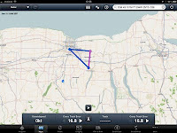
At the beginning of my shift I open Foreflight in the map mode, radar is best as I am able to check weather. (Image 1)
Create a route from home base to the nearest trauma hospital.Wait for a launch request message from my communication center which includes the town and county, bearing and distance, and expected hospital destination.Double check that the bearing and distance matches the launch request message, and if necessary adjust that waypoint by dragging it to the most accurate position you can.
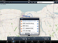
Place my finger on the center of the previously created route, and drag the middle of that track to the approximate destination. (Image 2) and touch "Add this coordinate to route"
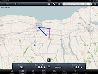
Now touch a point near home base. (This is necessary because if you touch home base it only offers to delete from route.) (Image 3)

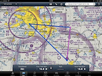
 Drag the point to home base and touch the home base waypoint listed. (Image 4) Note: if your home base is not in the Foreflight waypoint list, such as an airport or registered hospital landing site, create a user waypoint for your base per the Foreflight instructions.
Switch to VFR Sectional map, and by visual inspection determine the highest obstacle or terrain elevation within 2 nm of that route and record it.
Finally, I have asked the Foreflight Team to consider the ability to modify an existing route by bearing and distance once the waypoint is created by dragging the pre-stored track to the approximate scene location. In my wish list I would like to be able to rapidly create a point in space waypoint as described above, then modify it either by latitude and longitude or by bearing and distance. This would be quick, efficient, and above all, totally accurate.
Method 2 - the easy way!

 P.S. Got an email back from Team Foreflight after I wrote the note above. Jason, one of the co-founders, pointed out that you CAN enter a waypoint as a bearing and distance. All the above steps can be done like this, into the search box type HOME HOME/060/15.4 TRAUMA HOME where 060/15.4 is the bearing and distance from home base to the scene. Gobsmacked! I didn't know that! So forget all the above, just type it all in!
Cheers.

No comments:
Post a Comment